Simplifying Navigation to Help Locals and Tourists in Cebu
Project Description
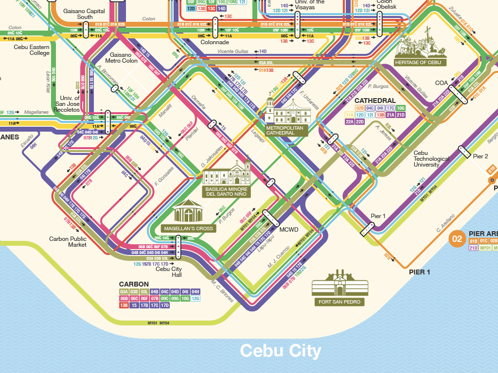
A transport network map of Cebu, Philippines, showing the routes and stops of the jeepney transport system.
Publish date
July 6, 2019
Tools & Technologies
Illustrator, QGIS, Google Maps
Activities
GIS mapping, QGIS data processing, transit map design, cartographic illustration
Cebu Jeepney Transport Network Map
The Cebu Jeepney Map project aimed to create a comprehensive and user-friendly visualization of Cebu City's complex jeepney routes, making public transportation more accessible to both locals and tourists. By adopting design principles from established transit systems like the New York subway and European metro maps, the goal was to bring clarity and modern wayfinding standards to this vital transportation network.
The process involved extensive route mapping using QGIS and Illustrator. The design went through several iterations to balance aesthetic appeal with practical usability, ultimately incorporating color-coding, simplified route representations, and clear interchange points while maintaining the cultural identity of the jeepney system.
Since its launch, the map has received +13k views and 106 appreciations on Behance, positive feedbacks from locals and tourists saying how the map helped their navigation in the city. The project has also inspired similar mapping initiatives in other Philippine cities, contributing to the modernization of public transportation information systems across the country.